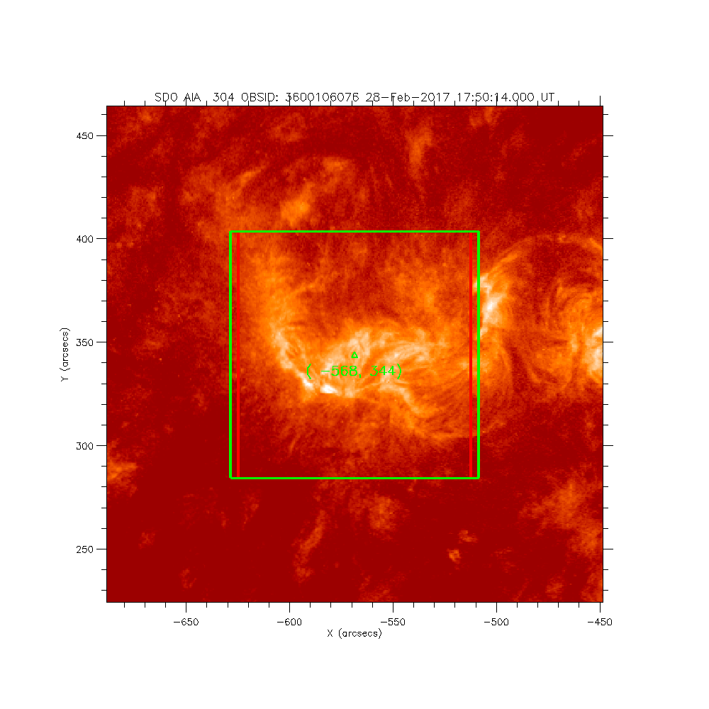
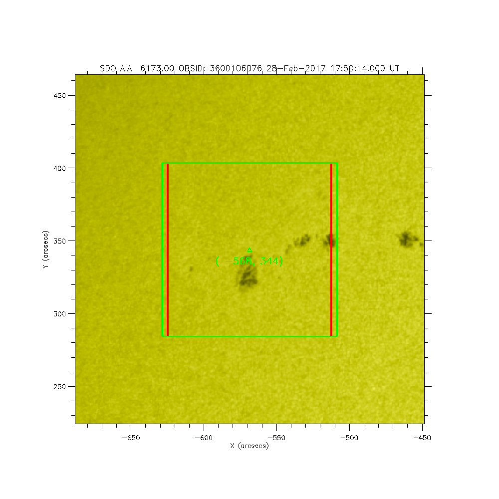
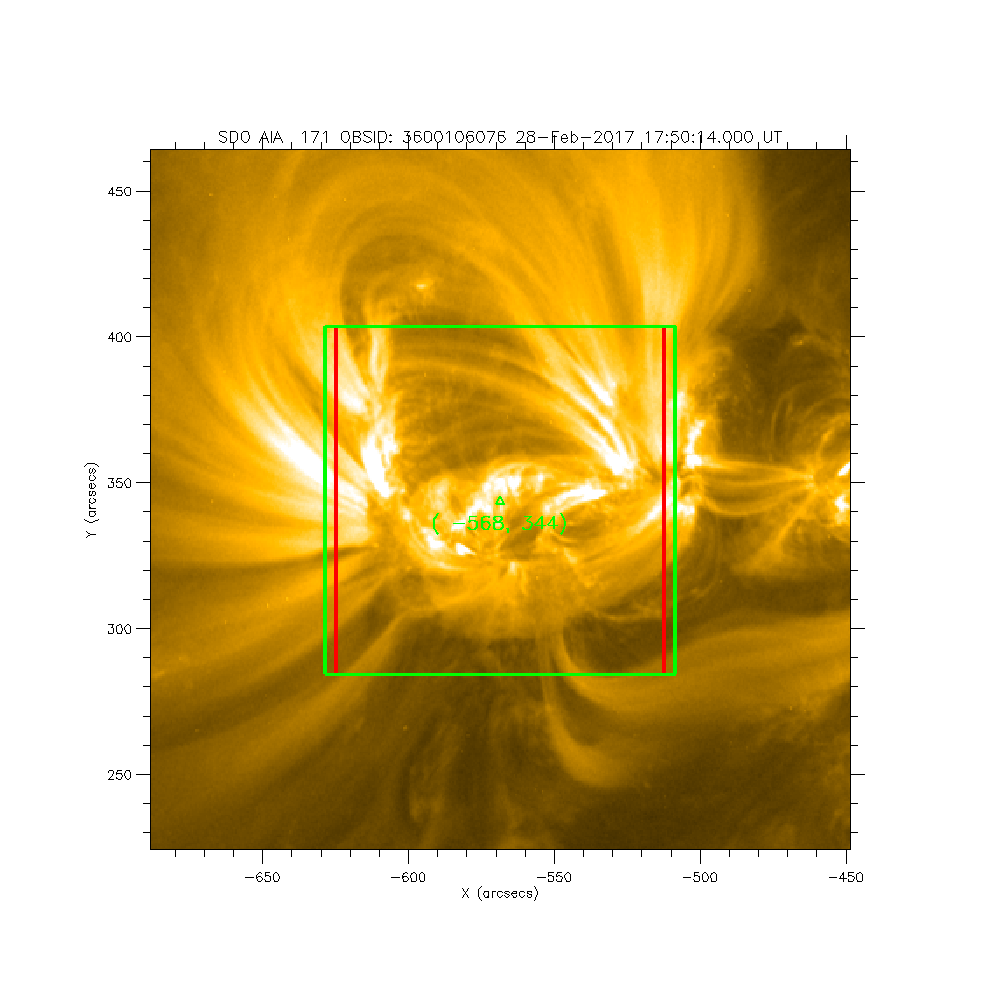
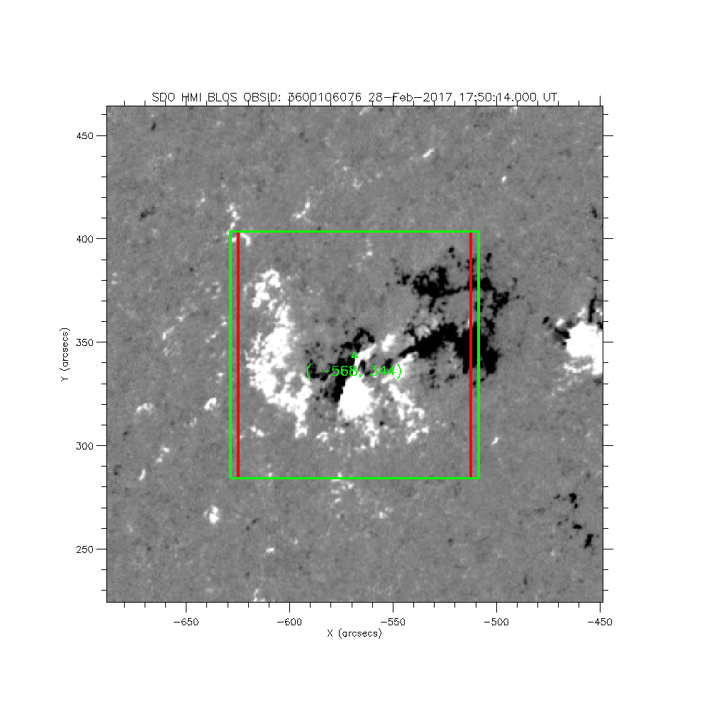
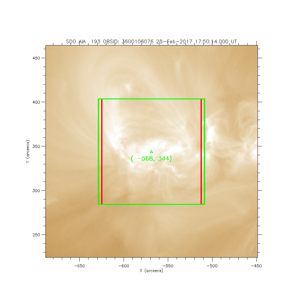
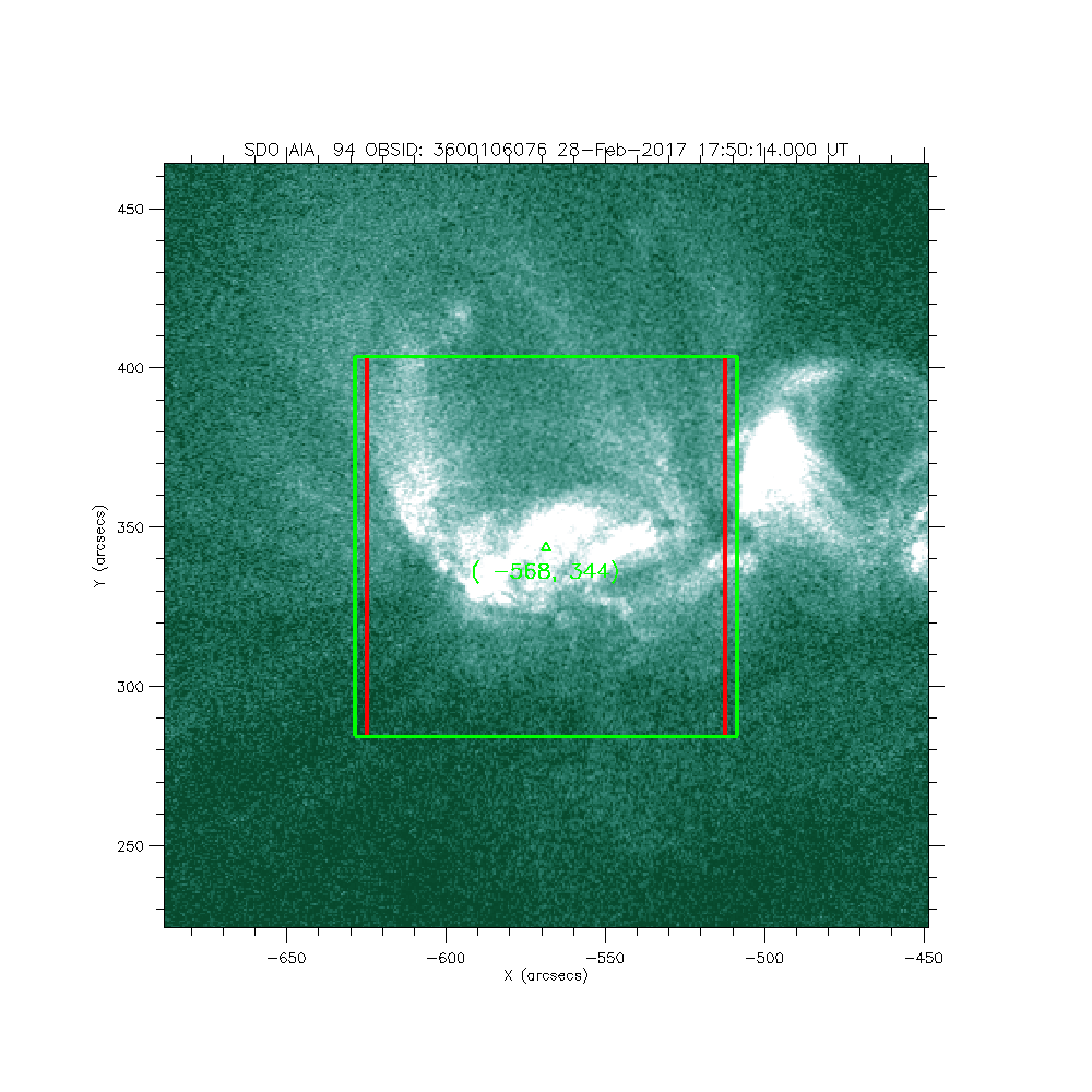
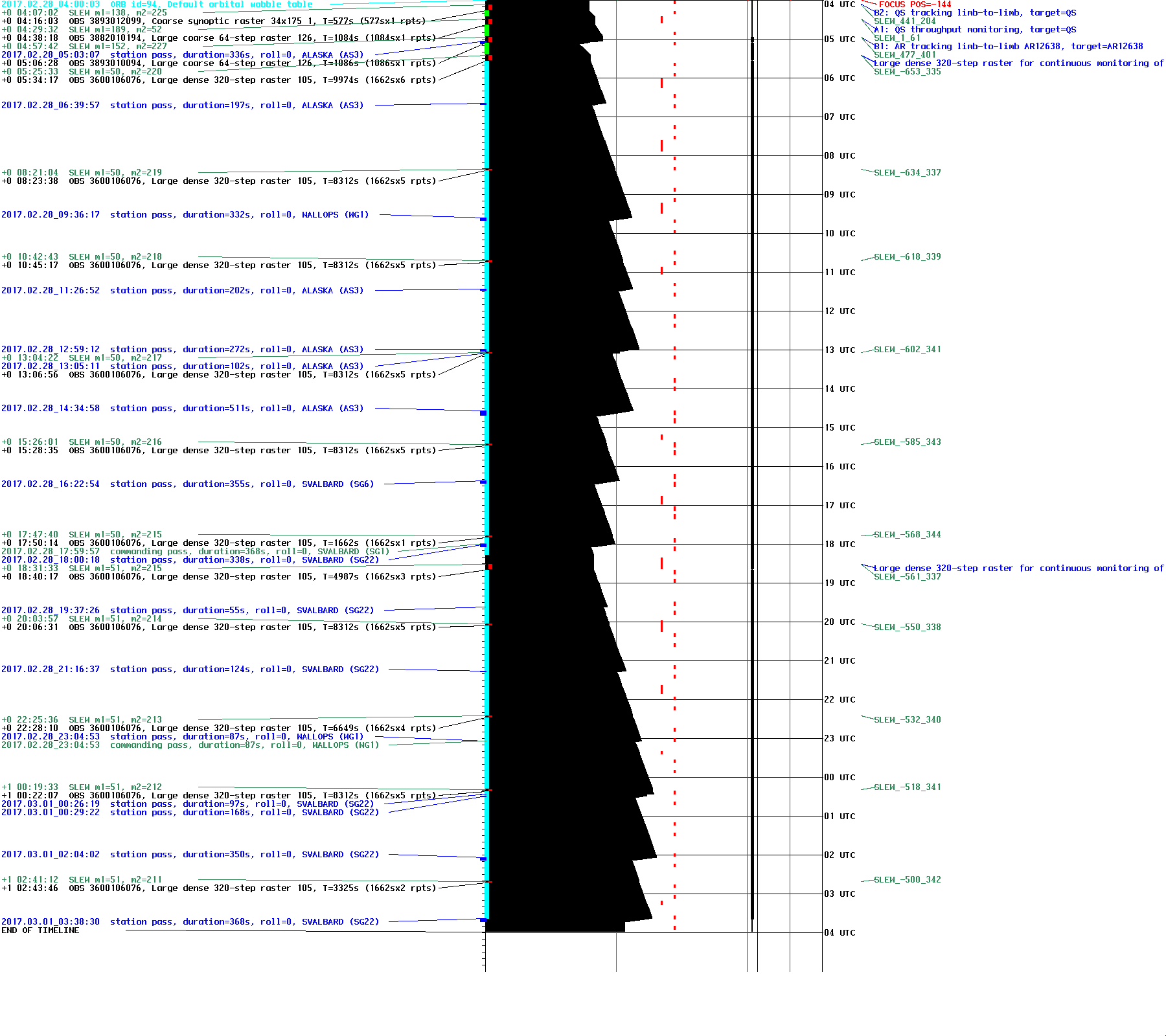
IRIS: Large dense 320-step raster for continuous monitoring of AR in NE
2017-02-28T17:50:14 to 2017-02-28T18:17:56
Program: OBS 3600106076: Large dense 320-step raster 105.3x120 320s Deep x 4 Spatial x 2, Spectral x 2
Target: AR
xcen=-568 ycen=344
Instrument: IRIS
Description:
Large dense 320-step raster for continuous monitoring of AR in NE
1 repeats of OBSID 3600106076 - Large dense 320-step raster 105.3x120 320s Deep x 4 Spatial x 2, Spectral x 2
IRIS roll: 0.0 degrees
IRIS planner pointing: (-653.0 arcsec, 335.0 arcsec)
OBS duration: 1662.3 seconds = 1 repeats x 1662.3 seconds/repeat
OBS data volume: 133.0 megabytes = 1063.9 megabits = 1662.3 seconds * 0.6 megabits/second

